
Carved directly into rugged mountain slopes over centuries, agricultural terraces demonstrate how human engineering can reshape hostile topographies i…
 1/6
1/6Honghe Hani Rice Terraces, Yunnan, China | Cascading down the slopes of the Ailao Mountains to the banks of the Red River, this 16,603-hectare UNESCO World Heritage landscape was carved by the Hani people over more than 1,300 years. The complex agro-ecological system relies on four integrated tiers: mountaintop forest catchments that trap rainfall, village settlements, terraced paddies, and the river valley below. Water is channelled continuously through a gravity-fed network of hand-dug canals and bamboo pipes, transforming the flooded paddies into reflective mirrors from November to March before the spring planting. (Image source: Wikimedia Commons)
 2/6
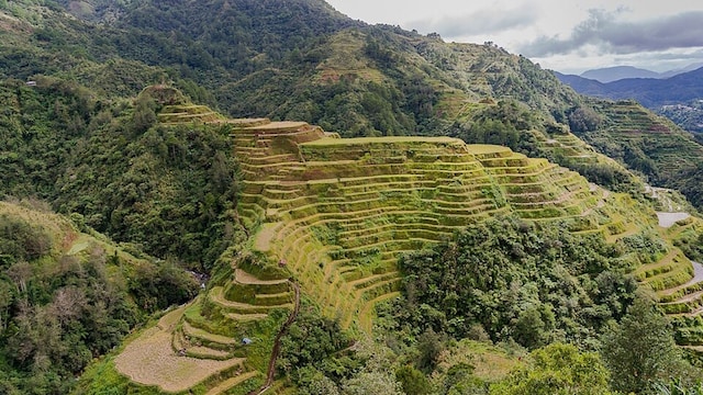
2/6Ifugao Rice Terraces (Batad & Bangaan Clusters), Luzon, Philippines | Stepped into the Cordillera Central mountains of northern Luzon, these high-altitude amphitheatre-style terraces were carved by the indigenous Ifugao people. Supported by stone and mud retaining walls that follow the natural contours of the mountain, the system is fed by stone conduits tapping freshwater from primary mountaintop rainforests. While popularly romanticised in folklore as 2,000 years old, archaeological excavations by the Ifugao Archaeological Project date the widespread construction of these wet-rice pond fields to roughly 300 to 400 years ago, coinciding with indigenous consolidation following the arrival of the Spanish. (Image source: Wikimedia Commons)
 3/6
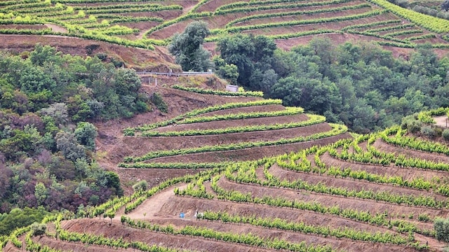
3/6Alto Douro Wine Region, Trás-os-Montes e Alto Douro, Portugal | Flanking the steep gorges of the Douro River in northeastern Portugal, this 24,600-hectare UNESCO cultural landscape represents more than 2,000 years of traditional viticulture. The schist mountain slopes feature traditional narrow stone-walled terraces, dating from the 18th and 19th centuries, alongside wider modern terraces designed for port wine production. Established in 1756 under the Marquis of Pombal, it became the world’s first formally regulated wine appellation system, using drystone walls to preserve fragile topsoil on slopes exceeding 40 degrees. (Image source: Wikimedia Commons)
 4/6
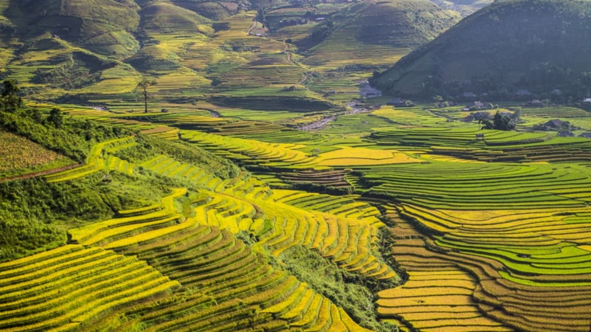
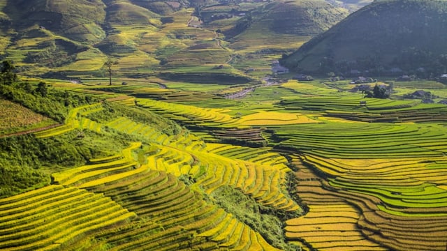
4/6Mu Cang Chai Rice Terraces, Yen Bai Province, Vietnam | Covering more than 2,200 hectares across the Hoang Lien Son mountain range, these terraced fields were sculpted by the indigenous Hmong community. Rising in tight, rhythmic rings up steep ridgelines between 1,000 and 1,500 meters above sea level, the paddies rely on wooden flumes and bamboo gravity aqueducts that tap mountain streams. The landscape shifts dynamically through two peak seasons: the flooded watering season in May and June, and the golden ripe harvest from mid-September to October. (Image source: Wikimedia Commons)
 5/6
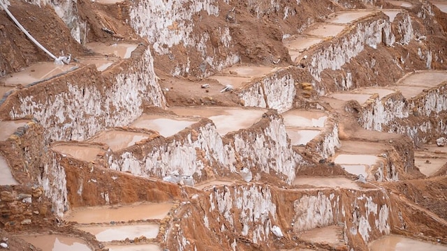
5/6Maras Salt Mines (Salineras de Maras), Sacred Valley, Peru | Comprising over 3,000 stepped terraced ponds built into the slopes of the Qaqawiñay mountain at an elevation of 3,200 meters, this evaporation complex dates back to pre-Inca cultures and expanded under the Inca Empire. The terraces are fed by a single subterranean spring which discharges warm, hypersaline water. Local communal families regulate the flow through a labyrinth of narrow channels, filling each polygonal pond to a depth of roughly 10 centimetres; solar evaporation leaves crystalline salt crusts that are manually harvested in three distinct grades. (Image source: Wikimedia Commons)
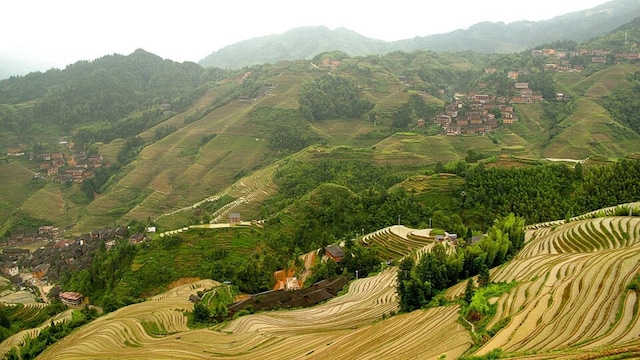 6/6
6/6Longji Rice Terraces (Dragon’s Backbone), Longsheng, Guangxi, China | Spanning elevations from 300 to 1,100 meters, the Longji terraces wind across the hillsides of Longsheng County, primarily cultivated by the Zhuang and Yao ethnic communities. Construction began during the Yuan Dynasty and continued through the early Qing Dynasty. The slopes reach gradients up to 50 degrees, forcing farmers to construct narrow, contoured strips that maximise rainwater retention and minimise erosion across steep subtropical karst terrain. (Image source: Wikimedia Commons)